


Namibia is arguably Southern Africa’s top self-drive holiday destination, thanks to its extensive road network, diverse landscapes, and spectacular wilderness areas. While most roads outside of cities are rough and untarred, you can still navigate much of the country in a standard vehicle. Formerly known as South West Africa, Namibia gained independence in 1990, shaking off the weight of a long, tragic colonial history. Today, people celebrate Namibia for its ancient cultures, incomparably vast deserts, and seemingly never-ending coastline.
With so much to see, a self-drive adventure is the best way to experience Namibia. Speak to our expert consultants today to find out more about car hire in Namibia.
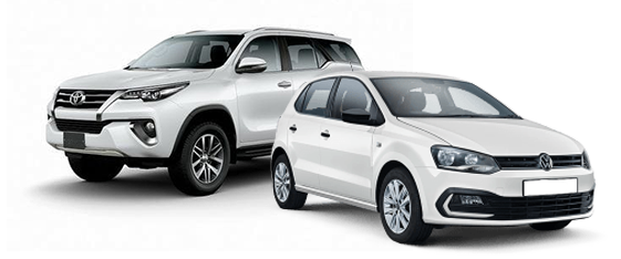
Our Fleet in Namibia
Our Namibian fleet is designed to cater to a wide range of travel needs. From the bustling streets of Windhoek to the sandy terrains of the Namib Desert, our vehicles are equipped to handle it all. Compact cars offer great fuel efficiency for city driving, while our SUVs provide the space and comfort needed for family trips. For adventurers, our 4x4s are perfect for exploring Namibia’s stunning landscapes and off-road trails. Luxury sedans and convertibles are also available for those seeking a premium driving experience. Each vehicle in our Namibian fleet is meticulously maintained and comes equipped with modern features for a safe and enjoyable journey.
Top 5 Places to Visit in Namibia
Namibia’s vast and varied landscapes offer an adventure like no other, from expansive deserts to lush wildlife areas. Hiring a car allows you to navigate this spectacular country at your leisure, uncovering hidden gems and iconic sites. Here are some top attractions to explore on your Namibian road trip.
Sossusvlei
Drive through the Namib Desert to reach Sossusvlei. Towering red sand dunes surround this iconic salt and clay pan. Climb Dune 45 for a breathtaking sunrise view.
Etosha National Park
Embark on a self-drive safari in Etosha National Park, one of Africa’s premier wildlife reserves. Spot elephants, lions, giraffes, and rhinos around the park’s waterholes.
Swakopmund
Experience driving around this coastal town known for its German colonial architecture, adventure sports, and access to the Namib Desert. Activities include sandboarding, quad biking, and dolphin cruises.
Skeleton Coast
Drive along this remote and hauntingly beautiful coastline. See shipwrecks, colonies of Cape fur seals, and the desolate beauty of the Atlantic Ocean meeting the desert.
Fish River Canyon
Explore the world’s second-largest canyon. Drive to the viewpoints for stunning vistas and consider hiking the multi-day Fish River Canyon Trail for an unforgettable adventure.
Car hire in Namibia provides a unique opportunity to explore its dramatic landscapes and rich natural beauty on your own terms. With our well-maintained fleet and convenient rental options, you can enjoy a seamless driving experience. Book your rental vehicle today and start your Namibian adventure with confidence.
How to Book Your Namibia Rental Car Online
Drive South Africa aims to make booking a rental vehicle for your Namibia journey effortless. Whether you’re exploring the stunning landscapes or visiting charming towns, our online process ensures you get the perfect vehicle. Follow these steps to secure your ride:
Step 1: Select Your Vehicle and Dates
Choose your vehicle type based on your needs (e.g., economy, SUV). Enter your pick-up and drop-off locations, along with the dates and times for your rental period. Check vehicle availability for your specified dates.
Step 2: Personalise Your Rental
Review the available options and select any additional features or services you may need, such as GPS navigation, child seats, additional drivers, or insurance coverage. Understand the terms and conditions, including mileage limits, fuel policies, and any extra fees.
Step 3: Provide Personal and Payment Information
Enter your personal details, including your name, contact information, and driving licence details. Then, input your payment information to secure the booking. Most rental companies require a credit card for reservations. Double-check all information to avoid mistakes.
Step 4: Confirm and Review Your Booking
Review all details to ensure accuracy, including the vehicle type, rental period, pick-up and drop-off locations, and total cost. Once confirmed, you will receive a booking confirmation via email. Keep this confirmation handy for picking up your rental vehicle.
By following these steps, you can easily book a rental vehicle online and enjoy a smooth rental experience with Drive South Africa.
Types of Rental Cars Available in Namibia
Explore the stunning landscapes of Namibia with the perfect rental car from Drive South Africa. Whether you need a compact car for city driving, an economy vehicle for affordability, or an SUV for rugged adventures, we have the right option for you.
Compact Cars
Compact cars are perfect for navigating the cities and towns of Namibia. Their small size makes them easy to park and manoeuvre through urban areas. Enjoy the fuel efficiency and convenience of a compact car in Namibia.
Economy Cars
Economy cars provide a great balance between cost and functionality. Ideal for longer journeys and highway driving, these cars offer enough space for small families or groups. Travel comfortably and affordably with our economy cars in Namibia.
SUVs
For those looking to explore Namibia’s rugged terrain and national parks, SUVs offer the durability and space required. High ground clearance and robust performance make them suitable for off-road conditions. Experience the versatility and comfort of an SUV in Namibia.